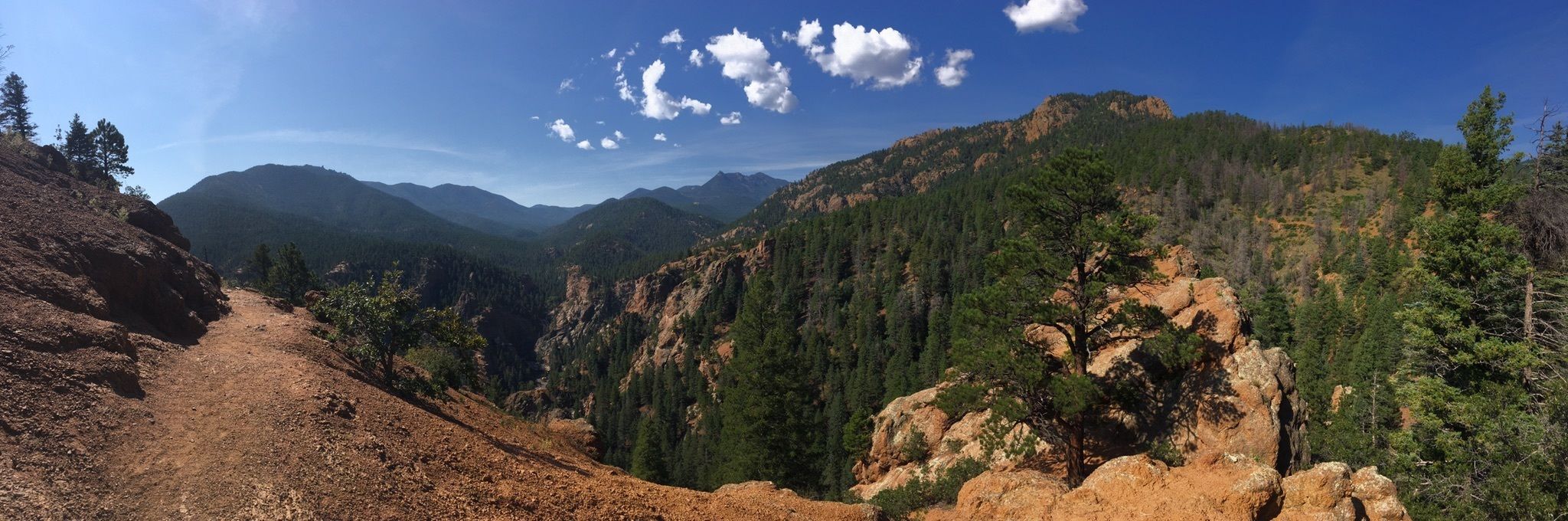
Columbine Trail
Parts of the trail follow North Cheyenne Creek, passing through towering ponderosa pines and steep cliffs and mountains.
General Description: This trail makes its way up the Cañon from behind the Starsmore Discovery Center to the Upper Columbine trailhead near Helen Hunt Falls and has 3 trailheads. The lower Columbine Trailhead starts at Starsmore. The Mid Columbine trailhead is about 1 mile up the road from the main park gate. The Upper Columbine trailhead is about 350 feet east of Helen Hunt Falls. Hikers, cyclists and equestrians can use this trail.
Directions to Trailhead: Directions
Download Trail Waypoints: Map
AllTrails Page: Link
Downloadable and/or printable visual guides to the Upper/Mid Columbine trails!
Mid-Columbine Uphill Guide (PDF)»
Upper Mid-Columbine Downhill (PDF)
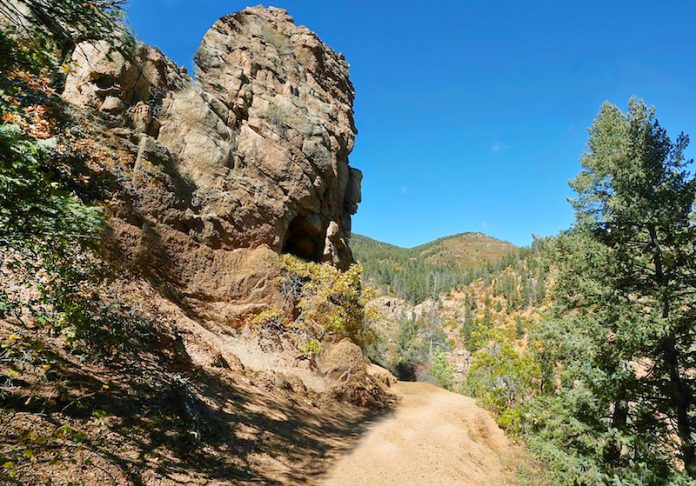
Seven Bridges
The trail follows a mountain stream and is one of the few cool hikes in the summer, even at mid-day.
General Description: Drive about 3.2 miles from the Starsmore Discovery Center to the parking area where North Cheyenne Canon Rd, High Dr. and Gold Camp Rd. intersect. Park here. Hike along the closed portion of Gold Camp Rd. to Tunnel #3.Follow the trail up and over the tunnel to St. Mary's Falls.St.
Directions to Trailhead: Directions
Download Trail Waypoints: Map
AllTrails Page: Link
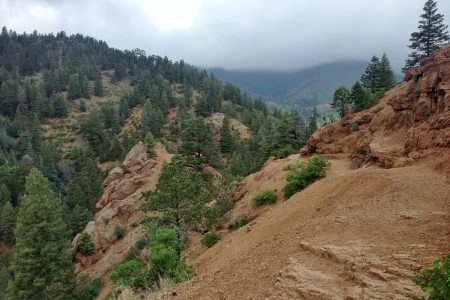
Buckhorn Loop
General Description: The trailhead is directly east of Tunnel #1 at the multi-use trail sign. The Captain Jacks Trail system is a multi-use system that allows hikers, bicyclists, equestrians, and motorcycles. For those who are up for a real challenge, the Captain Jacks Trail joins with the Jones Park Trail at the saddle behind Mt. Buckhorn, and the trail continues for another 2.4 miles to Jones Park.(1.2 miles in park; 2.25 miles in Pike National Forest)
Directions to Trailhead: Directions
Download Trail Waypoints: Map
AllTrails Page: Link
Saint Mary's Falls
General Description: Drive about 3.2 miles from the Starsmore Discovery Center to the parking area where North Cheyenne Canon Rd, High Dr. and Gold Camp Rd. intersect. Park here. Hike along the closed portion of Gold Camp Rd. to Tunnel #3.Follow the trail up and over the tunnel to St. Mary's Falls.St. Mary's Parking - to the leftSeven Bridges Parking - to the right for High Drive entrance
Directions to Trailhead: Directions
Download Trail Waypoints: Map
AllTrails Page: Link
Silver Cascade Falls
Silver Cascade Falls is a waterfall located on St. Mary's Creek in North Cheyenne Cañon Park.
Mount Muscoco
General Description: Follow Mt. Cutler Trail until Mt. Muscoco Trail sign points to the right. The trail gets steeper as you go along. After reaching a lookout area, the trail continues to the west. It now merges into the old trail and the footing becomes a bit rougher. At about the 2 mile point, there is a sign for “Mt. Muscoco Summit” with an arrow to the left. Now the hard part begins! Watch for cairns (small piles of rocks to mark the trail) and try to follow a poorly defined footpath. Stay towards the left side of the rock summit (looking up) as you ascend. This is a scramble! At the top, there is an easy trail (about 1/10 mile) to the right which ends at an overlook. The summit has a 360 degree view. Hikers only.
Directions to Trailhead: Directions
Download Trail Waypoints: Map
AllTrails Page: Link
Mount Cutler
This trail is a well defined quick summit and popular with families. It is a great first trail for anyone new to the area or not used to hiking.
This trail is well defined and popular with families. It is a great first trail for anyone new to the area or not used to hiking
Starting from the trailhead off the canyon road the trail starts climbing through the forest. At the saddle under the summit you will be rewarded with nice view of the Seven Falls. Once you reach the top a small spur to the north leads to the true summit but it is worth continuing a little bit further east to an outcrop with great views of the city.
Directions to Trailhead: Directions
Download Trail Waypoints: Map
AllTrails Page: Link
Graduation Boulder
No topo. Bouldering from the roadside! A few highballs scale the steep, creekside of the boulder on slopey, polished edges. Classic V0 warm-ups face the road.
Approach by driving 0.7 miles past the canyon's mouth and park next to Graduation Boulder.
Directly across the creek and 30 feet uphill lies another boulder with several excellent challenges, including the full right-to-left lip traverse, Tough Guy (V7).
River Rumble (V4) pulls straight out the main north-facing overhang to the slab above.
The Pinnacle (North Face)
This crag rises directly south above Graduation Boulder.Approach by driving 0.85 miles past the canyon entrance to a pullout on the right (west) side of the paved road. Cross the road and a stone bridge over the creek. A rough trail works up the eroded hillside to the base.Routes are listed from right to left.2. Cheyenne (5.11b)3. Chivalry (5.10c)4. The Shiiter (5.12a)5. Balance (5.8) Fun moderate.6. Unknown (5.9) Exit right to #5's anchors.7. Tiger Snap (5.10d) Excellent. Follow beautiful edges up a blunt prow.8. Dragnet (5.11a) Two pitches, or one long 11-bolt route.9. Full Monte (5.11a)10. The Army Route (5.5) Four pitches.A classic put up by the US Army in the 1950s. The line is mostly fixed, with two-bolt anchors at each belay.Gear: In addition to quickdraws, carry a small rach of medium to large stoppers, and a small to medium cams.Descent: Carefully downclimb the south side onto a gravel ridge (belay optional).Walk south to more downclimbing to a scree slope that traverses to a saddle. Descend west down a scree gully to the road. 11. Roof Route (5.11+) 12. Wartime (5.8) 13. Corrugation Corner (5.10c).
Sun Slabs (The Pinnacle, East Face)
This is the lower, east-facing wall around the buttress from The Pinnacle, North Face.Approach from the northfacing wall, hike southeast around the corner and downclimb to an old prospect hold filled with water below a vertical wall.Routes are listed right to left.14. Slant Eye (5.9) Liebacks, jams and face climbing. Gear: Stoppers and small to medium cams.15. RopeKill (5.7). A short first pitch leads to the second, El Nino (5.11a). 16. Sizzle (5.11b).